User Tools
Sidebar
japan:tokyo_hiking:sekirouzan
Sekirouzan/石老山 trip
operating instructions
Various functions are available as part of the map.
mouse/touch operation
- moving by grabbing the map with a mouse-click you can move the map around
- overview map using the < button in the bottom right of the map you can expand an overview map
- zooming in and out using the + and - buttons in the top left of the map you can obtain more or less detail in the map
- switching themes or maps clicking on the ≡ icon on the right-hand side of the map you can view and select available maps and themes
- retrieving information the map may contain elements that contain more information, by clicking these a popup will show this information
- fullscreen display using the ⛶ button the map can be maximized to fullscreen display, use the ▢ button to return to page display.
keyboard operation
Keyboard operation becomes available after activating the map using the tab key (the map will show a focus indicator ring).
- moving using the arrow keys you can move the map
- overview map using the + button in the bottom right of the map you can expand an overview map
- zooming in and out using the + and - buttons in the top left of the map or by using the + and - keys you can obtain more or less detail in the map
- switching themes or maps clicking on the ≡ icon on the right-hand side of the map you can view and select available maps and themes
- retrieving information the map may contain elements that contain more information, using the i key you can activate a cursor that may be moved using the arrow keys, pressing the enter will execute an information retrieval. press the i or the escape key to return to navigation mode
- fullscreen display using the ⛶ button the map can be maximized to fullscreen display, use the ▢ button to return to page display.
It's possible that some of the functions or buttons describe above have been disabled by the page author or the administrator

| id | symbol | latitude | longitude | description |
|---|---|---|---|---|
| Sagamiko station/相模湖駅, Sekirouzan/石老山 trip | ||||
 |
 |
GPX track: track2019-09-22 石老山 | ||
trip details
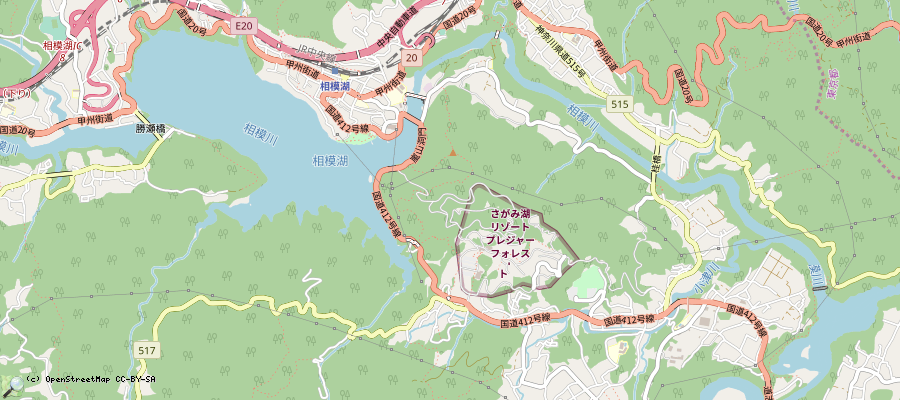
- take train to Sagamiko station/相模湖駅 (~90min from Shinjuku)
- then walk to bus station 石老山入口(バス)(50min walking - nice views over the Sagamiko lake, or take the bus)
- then climb up Sekirouzan/石老山.
- from the top, you can leave the mountain via the path in the Northwest. Go down until the bus station プレジャーフォレスト前(バス). Climbing up from the bus station, and down again might take 3h or 3h30min.
- 5min to the north, there is an entertainment park and the Lake Sagamiko Onsen “Ururi” Hot spring, worth a visit.
- then go back to Sagamiko station by foot or via bus. Back to Tokyo via train.
- trip log: 20190922
japan/tokyo_hiking/sekirouzan.txt · Last modified: 2022/11/13 12:06 by 127.0.0.1
Page Tools
Except where otherwise noted, content on this wiki is licensed under the following license: CC Attribution-Share Alike 4.0 International

