User Tools
Sidebar
japan:tokyo_hiking:honnitasan
Honnitasan/本仁田山 trip
operating instructions
Various functions are available as part of the map.
mouse/touch operation
- moving by grabbing the map with a mouse-click you can move the map around
- overview map using the < button in the bottom right of the map you can expand an overview map
- zooming in and out using the + and - buttons in the top left of the map you can obtain more or less detail in the map
- switching themes or maps clicking on the ≡ icon on the right-hand side of the map you can view and select available maps and themes
- retrieving information the map may contain elements that contain more information, by clicking these a popup will show this information
- fullscreen display using the ⛶ button the map can be maximized to fullscreen display, use the ▢ button to return to page display.
keyboard operation
Keyboard operation becomes available after activating the map using the tab key (the map will show a focus indicator ring).
- moving using the arrow keys you can move the map
- overview map using the + button in the bottom right of the map you can expand an overview map
- zooming in and out using the + and - buttons in the top left of the map or by using the + and - keys you can obtain more or less detail in the map
- switching themes or maps clicking on the ≡ icon on the right-hand side of the map you can view and select available maps and themes
- retrieving information the map may contain elements that contain more information, using the i key you can activate a cursor that may be moved using the arrow keys, pressing the enter will execute an information retrieval. press the i or the escape key to return to navigation mode
- fullscreen display using the ⛶ button the map can be maximized to fullscreen display, use the ▢ button to return to page display.
It's possible that some of the functions or buttons describe above have been disabled by the page author or the administrator

| id | symbol | latitude | longitude | description |
|---|---|---|---|---|
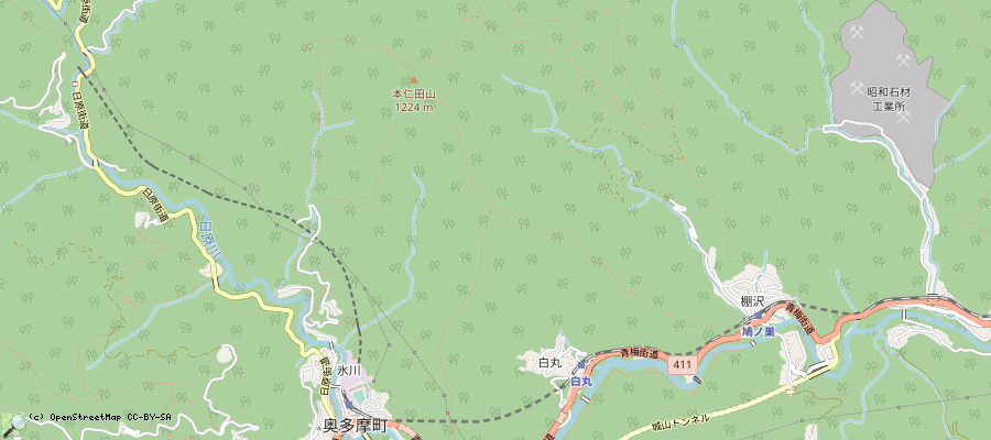
| Okutama/奥多摩, Honnitasan/本仁田山, 鳩ノ巣/Hatonosu trip | ||||
 |
 |
GPX track: track2019-10-05 奥多摩 本仁田山 | ||
trip details
- take train to Okutama station/奥多摩駅 (~120min from Shinjuku)
- walk towards north, up Honnitasan/本仁田山. This first part is quite steep, from 200m to 1200m.
- It's a good idea to bring food with you, there are no stores at the top. Okutama station has some konbini stores.
- leave the mountain towards North, the opposite from where you came, towards 鳩ノ巣駅
- the overall trip was said to take 5h30, but it turned out 3h30 for me
- at 鳩ノ巣, there is a small onsen in a hotel at 35.813505, 139.126803 : https://www.okutamas.co.jp/hatonosu/ . Bring in a towel. Apparently only open for non-hotel-guests until 3pm. The onsen view is probably fantastic in November.
- trip log: 20191005: not yet autumn but nice weather
japan/tokyo_hiking/honnitasan.txt · Last modified: 2022/11/13 12:06 by 127.0.0.1
Page Tools
Except where otherwise noted, content on this wiki is licensed under the following license: CC Attribution-Share Alike 4.0 International

