User Tools
Sidebar
japan:tokyo_hiking:mitakesan-otakesan
御嶽山/(Mnt. Mitake)/大岳山(Odake) trip
operating instructions
Various functions are available as part of the map.
mouse/touch operation
- moving by grabbing the map with a mouse-click you can move the map around
- overview map using the < button in the bottom right of the map you can expand an overview map
- zooming in and out using the + and - buttons in the top left of the map you can obtain more or less detail in the map
- switching themes or maps clicking on the ≡ icon on the right-hand side of the map you can view and select available maps and themes
- retrieving information the map may contain elements that contain more information, by clicking these a popup will show this information
- fullscreen display using the ⛶ button the map can be maximized to fullscreen display, use the ▢ button to return to page display.
keyboard operation
Keyboard operation becomes available after activating the map using the tab key (the map will show a focus indicator ring).
- moving using the arrow keys you can move the map
- overview map using the + button in the bottom right of the map you can expand an overview map
- zooming in and out using the + and - buttons in the top left of the map or by using the + and - keys you can obtain more or less detail in the map
- switching themes or maps clicking on the ≡ icon on the right-hand side of the map you can view and select available maps and themes
- retrieving information the map may contain elements that contain more information, using the i key you can activate a cursor that may be moved using the arrow keys, pressing the enter will execute an information retrieval. press the i or the escape key to return to navigation mode
- fullscreen display using the ⛶ button the map can be maximized to fullscreen display, use the ▢ button to return to page display.
It's possible that some of the functions or buttons describe above have been disabled by the page author or the administrator

| id | symbol | latitude | longitude | description |
|---|---|---|---|---|
| 御嶽山/(Mnt. Mitake)/大岳山(Odake) trip | ||||
 |
 |
GPX track: track2021-09-11-御嶽 奥多摩 | ||
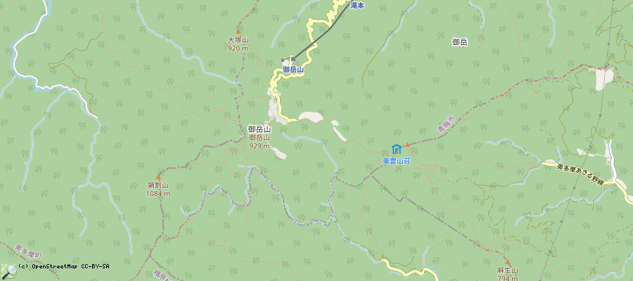
御嶽山/(Mnt. Mitake)/大岳山(Odake)/鋸山(Nokogirisan)
- Drive to Mitake station/御嶽駅 (90min from Shinjuku)
- Then go to 'Takimoto cable car Station for Mt. Mitake'/御岳登山鉄道, either by foot (45min) or by bus
- Then either take the cable car or walk up
- On the top, there is the Musashi-Mitake Shrine (武蔵御嶽神社)
- Then you can go to 大岳山(Odakesan, 1266.5m)
- Then via 鋸山(Nokogirisan) you can go to 奥多摩駅(Okutama station)
- All in all ~6.5hours
- On the way back to Tokyo, one passes through Kabe-satation, a nice onsen is next to the station.
- Trip reports:
- 20200113: middle of January I could just go to ~1200meter, then the soil was frozen over and slippery. When using Eisen/spikes, it should be ok.
- 20200606: 26°C and high humidity, very nice walking - only light clothes recommended: short trousers, light t-shirt. Including Odakesan summit, it did not feel cold.
- 20210911: hot and very humid, a bit of rain (not really felt because of the trees). That day, above gps track was taken.
japan/tokyo_hiking/mitakesan-otakesan.txt · Last modified: 2022/11/13 12:06 by 127.0.0.1
Page Tools
Except where otherwise noted, content on this wiki is licensed under the following license: CC Attribution-Share Alike 4.0 International

