User Tools
Sidebar
japan:tokyo_hiking:tanzawa_ooyama
大山/Ooyama trip
operating instructions
Various functions are available as part of the map.
mouse/touch operation
- moving by grabbing the map with a mouse-click you can move the map around
- overview map using the < button in the bottom right of the map you can expand an overview map
- zooming in and out using the + and - buttons in the top left of the map you can obtain more or less detail in the map
- switching themes or maps clicking on the ≡ icon on the right-hand side of the map you can view and select available maps and themes
- retrieving information the map may contain elements that contain more information, by clicking these a popup will show this information
- fullscreen display using the ⛶ button the map can be maximized to fullscreen display, use the ▢ button to return to page display.
keyboard operation
Keyboard operation becomes available after activating the map using the tab key (the map will show a focus indicator ring).
- moving using the arrow keys you can move the map
- overview map using the + button in the bottom right of the map you can expand an overview map
- zooming in and out using the + and - buttons in the top left of the map or by using the + and - keys you can obtain more or less detail in the map
- switching themes or maps clicking on the ≡ icon on the right-hand side of the map you can view and select available maps and themes
- retrieving information the map may contain elements that contain more information, using the i key you can activate a cursor that may be moved using the arrow keys, pressing the enter will execute an information retrieval. press the i or the escape key to return to navigation mode
- fullscreen display using the ⛶ button the map can be maximized to fullscreen display, use the ▢ button to return to page display.
It's possible that some of the functions or buttons describe above have been disabled by the page author or the administrator

| id | symbol | latitude | longitude | description |
|---|---|---|---|---|
| 大山/Ooyama trip | ||||
 |
 |
GPX track: track2020-08-08-大山 | ||
大山(Mount Ouyama, 神奈川県)
- course:
- go to Isehara-station(伊勢原), best around morning, 8:00
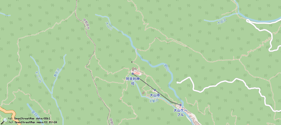
- take bus until station 大山ケーブル (35.6579525, 139.6669422), ~25min
- then either take cable car, or one of 2 ways to the plateau (30 or 40min, both are quite steep)
- then climb up to the top. Climbing up takes 90min, down to the plateau 60min. Downwards, you can either take the way you were coming up, or (recommended, and that's also shown in the gpx file on above map) take an other way. Identiying the other way downwards can be challenging, android app Osmand (with openstreetmap cards) can help pointing the way out.
- the way is quite challenging, see also rating here: http://www.yamaquest.com/detail/oyama-1252/569.html
- In main seasons, the shop at the summit is open, but I think there is no real speciality
- visit log:
- 20161010
- 20180422, 2019
- 20200808: hot (30°C) and humid, but views were not to bad, just a bit mist
japan/tokyo_hiking/tanzawa_ooyama.txt · Last modified: 2022/11/13 12:06 by 127.0.0.1
Page Tools
Except where otherwise noted, content on this wiki is licensed under the following license: CC Attribution-Share Alike 4.0 International

